Media Release: Empowering Food Handlers: Food Safety & Hygiene Training at Meals on Wheels Community Service
Media Release: Empowering Food Handlers: Food Safety & Hygiene Training at Meals on Wheels Community Service
For immediate release
21 May 2026
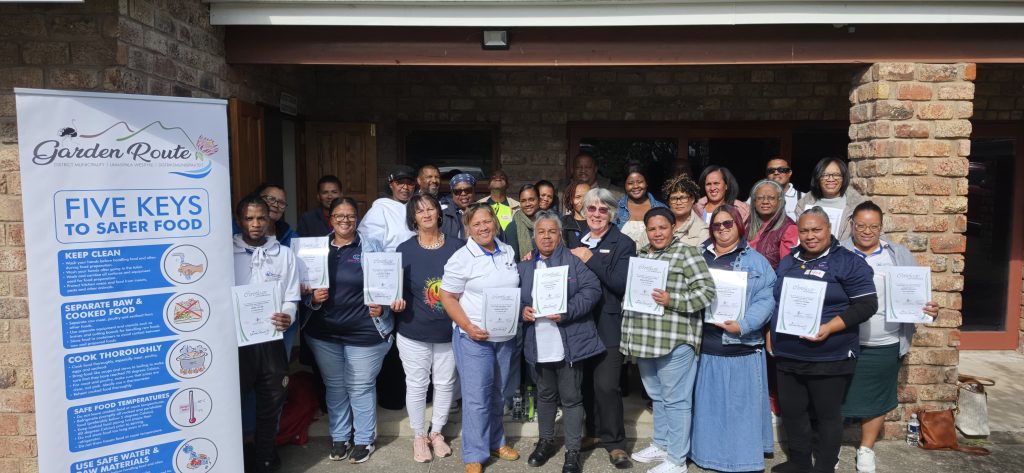
A Food Safety and Hygiene Training session was recently facilitated for the food handlers of Meals on Wheels Community Services (MOWCS). MOWCS serves some of the most vulnerable members of the community, including the elderly, the frail, and children. These individuals are at a higher risk of complications from foodborne illnesses. “This makes food safety not merely a regulatory requirement, but a direct expression of care and dignity for every person who receives a meal,” said Nonkosi Somwahla, Environmental Health Practitioner (EHPs) at the Garden Route District Municipality (GRDM).
As a non-profit organisation involved in the preparation and serving of food, MOWCS is required to hold a valid Certificate of Acceptability (COA) and ensure that all food handlers receive adequate training in Food Safety and Hygiene.
The training was presented by GRDM’s EHPs. The aim was to equip participants with the knowledge and practical skills required to handle, prepare, and serve food safely, while ensuring compliance with South African food safety legislation.
The session covered key areas of food safety relevant to the day-to-day work of the MOWCS team, including the identification and control of food safety hazards, safe food handling practices, personal hygiene standards emphasise the importance of washing hands, and the maintenance of clean, pest-free premises. Participants engaged actively throughout the session, which was well received by all in attendance.
All attendees who participated in the Food Safety and Hygiene Training received Certificates of Attendance at the end of the session in recognition of their participation and commitment to improving food safety practices.
The training was well received, with positive feedback from Meals on Wheels leadership. The Regional Director of Meals on Wheels, Mr Jeremy Vlotman, shared the following feedback with the EHP, Nonkosi Somwahla: “Thank you for a professional and informative presentation. We have received positive feedback thus far; our next step is to ensure implementation.”
The EHP’s looks forward to supporting Meals on Wheels Community Services through this process, including follow-up visits and ongoing guidance as needed.
-END-