
Author: Marlene Nqumse

21 May 2021 Media Release: Rural Roads Asset Management Systems Grant Annual Meeting
Media Release: Rural Roads Asset Management Systems Grant Annual Meeting
For Immediate Release
21 May 2021
On Wednesday, 5 May 2021, Roads Services Representatives from National Government, the five (5) District Municipalities in the Western Cape and local municipalities within the Garden Route District gathered for the quarterly Rural Roads Asset Management System (RRAMS) meeting at Oubaai in George.

Over the past ten years, the RAMS (Roads Asset Management System) Conditional Grant has been used in South Africa to transfer funding to provinces and district municipalities (with preference to those in the rural areas), to achieve national government policy objectives. Furthermore, to ensure efficient and effective investment in municipal roads by developing road asset management systems (RAMS) through the collection and analysis of data.
With the above in mind, the primary purpose of the RRAMS Grant as stipulated in the Division of Revenue Bill is to assist district municipalities in setting up rural RAMS and collecting road, bridges, and traffic data on municipal road networks in line with the Road Infrastructure Strategic Framework for South Africa.
As part of the National Government’s strategy to capacitate GRDM to fulfil the RAMS function in-house, four (4) contract positions were created and filled by two Civil Engineering graduates, a GIS operator and an Administration Assistant. GRDM also purchased two (2) Toyota LDV bakkies valued at R433 163.00 each, which will be utilised by the newly appointed RRAMS personnel.
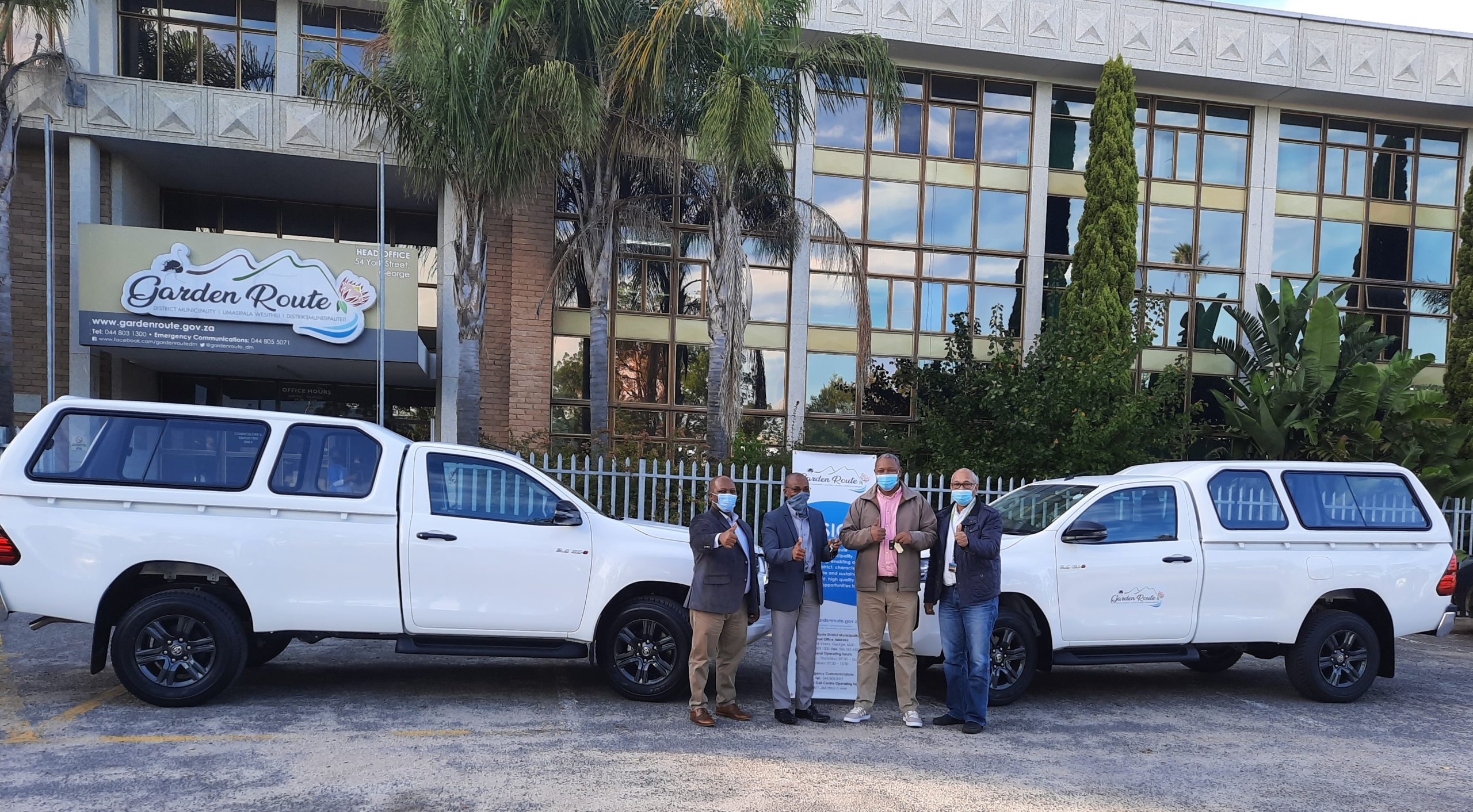
On Wednesday, 18 May 2021, the Garden Route District Municipality Executive Mayor Alderman Memory Booysen, and the Municipal Manager, Mr Monde Stratu, received the two (2) bakkies during a small handover ceremony. The Portfolio Chairperson of Roads and Transport Planning Services, Cllr Rowan Spies, and the Executive Manager: Roads and Transport Planning Services, Mr John Daniels, also attended the ceremony. The Roads department will manage these assets.


21 May 2021 Media Release: Fencing subsidies available – call for applications
Media Release: Fencing subsidies available – call for applications
For Immediate Release
21 May 2021
On an annual basis, Garden Route District Municipality (GRDM) provides fencing subsidies for a selected number of landowners on neighbouring provincial rural roads with fencing of their properties.
This is subject to a budget as received from the Western Cape Government.
The funding will only be applicable on a subsidy basis. It effectively means that 60% subsidy will be contributed towards the cost of the fencing. The subsidy is determined by an average price for the material. The material is deemed as 60% of the total cost. Labour cost is deemed as 40% of the total cost and must be carried by the applicant. All initial costs must be carried by the applicant and a subsidy will be paid out after the successful completion of the fence. For more information refer to the Fencing Subsidy Policy of Garden Route District Municipality.
The new fences must adhere to the specifications of the Provincial Government of the Western Cape: Roads Infrastructure Department. Minimum specifications will be made available to successful applicants.
Application process
- Application forms can be obtained from Mr Qamani Nkebana at the Roads Transport & Planning Department. Contact numbers at the office are 044 803 1506 or email Qamani@gardenroute.gov.za. Alternatively, download from www.gardenroute.gov.za.
- Application period: 21 May 2021 to 18 June 2021.
- Applications will be audited and evaluated according to risk analysis by a panel. Risk factors include: Status of road, traffic count, operating speed of vehicles, type of farming, condition of current fence, etc.
- The panel outcome will be decided by 19 July 2021. All applicants will be informed. A fencing subsidy contract will be signed with successful applicants. Unsuccessful applicants can apply again in the next financial year.
- All fences must be fully completed by 10 December 2021 for payment before 28 February 2022.
- Payment will be done after an inspection and approval for the fence has been made.
Closing date: 18 June 2021
Notice number: 43/2021
Relevant Documents
Fencing-subsidy-letter-for-applying-applicants-2021

20 May 2021 Save the Date: Council Meeting on 25 May 2021 at 11:00 am
Save the Date: Council Meeting on 25 May 2021 at 11:00 am


20 May 2021 Weather Alert: Impact Based Weather Warnings for Western Cape and Namaqua
20 May 2021 Weather Alert: Impact Based Weather Warnings for Western Cape and Namaqua
Please find included the Updated Impact Based Warning for the Western Cape and Namaqua Region of Northern Cape
Legal notice:
“This warning from SA Weather Service must be communicated as received and may not be altered under any circumstance.
It must be forwarded or communicated in its entirety and no portion hereof may be replicated or copied and distributed.”
| Hazard | Alert Level | Affected Municipalities | Valid From (SAST) | Valid To (SAST) |
| Damaging Waves | Yellow(L2) | Bitou, Cape Agulhas, Cape Agulhas, City of Cape town, George, Hessequa, Knysna, Mossel Bay, Overstrand, Saldanha Bay, Swartland, Table Bay | 20/05/21 – 00h00 | 21/05/21 – 00h00 |
Discussion: A series of cold frontal systems passing over the Western Cape Province causes significant wave heights of 4.0 to 5.0m between Cape Columbine and Cape Agulhas on Thursday afternoon, spreading to Plettenberg Bay by the evening. The wave heights are expected to reach 5.5 to 6.0m between Cape Point and Cape Agulhas on Thursday night, spreading to Plettenberg Bay on Friday morning, subsiding by the evening.
Impact: Difficulty in navigation at sea can be expected with strong winds and large waves where small vessels might be at risk of taking on water and capsizing in a locality. Beachfront activities will be disrupted and anglers and beach-goers on low-level rocks are at risk of being caught off guard from infrequent large waves and swept off the rocks.
Instruction: Be aware of large unpredictable waves along the coast. Small vessels are advised to seek shelter in harbours, bays or inlets.